- This website reflects our views on the Terminal 5 site based on many years of post-excavation analysis, which culminated in the publication of the final volume of the T5 report in 2010.
The Heathrow Landscape
How do we know this?
Find out more details in our archaeological evidence sectionHeathrow Airport
The Archaeologists
Framework Archaeology
Tag Archives: animation
100 BC-400 AD A New Direction

Roman settlement and landscape.
From 100 BC (Late Iron Age) the people of southern Britain came into increasing contact with the Roman Empire, culminating in AD 43 with the Roman invasion of Britain. For the next 370 years Britain became tied into the political and economic structure of the Roman Empire. At Heathrow, the old Middle Iron Age settlement became a focal point for continuing occupation through into the later Iron Age and early Roman period, although parts of the landscape were radically altered at this time, with new alignments of field systems largely overwriting the previous land divisions. While animal husbandry remained a fundamental part of the agricultural economy, the evidence suggests an increasing emphasis on cereal crops from the Late Iron Age onwards. The settlement complex appears to have been continually modified on a somewhat ad hoc basis throughout the Roman period, and would have undoubtedly become an integral part of the emerging Roman economy, with trackways being cut across the ancient landscape to serve the new markets at nearby Staines and the growing city of Londinium.
During the later Roman period (from the 3rd century AD) radically new styles of structure and wholesale changes to the eastern field systems were introduced, resulting in a substantial ‘ladder’ enclosure system, surrounding a major central droveway, designed to accommodate high levels of livestock traffic. The impetus for such development was probably commercial, perhaps driven by wealthy estate owners to maximise profits in a steadily changing economic environment. Farms like the one at Terminal 5 may have been incorporated into large managed agricultural estates (latifundia), perhaps belonging to the owners of more remote villas and/or wealthy townhouses in London. Rural farmers on these estates may have become coloni, essentially subsistence workers who were tied to the land in service of the estate, though also able to produce a meagre surplus for themselves.
Bronze Age settlement animation
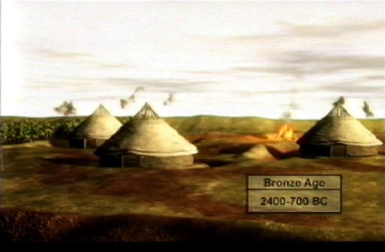
Download an animation showing the Bronze Age settlement (requires QuickTime).
©BAA 2003
Produced by Marshall Lightfoot plc
Reproduced by kind permission BAA
Bronze Age water hole animation
![]() Download an animation showing a water hole of Bronze Age date (requires QuickTime).
Download an animation showing a water hole of Bronze Age date (requires QuickTime).
©BAA 2003
Produced by Marshall Lightfoot plc
Reproduced by kind permission BAA
Iron Age settlement animation
![]() Download an animation showing the Iron Age settlement (requires QuickTime).
Download an animation showing the Iron Age settlement (requires QuickTime).
©BAA 2003
Produced by Marshall Lightfoot plc
Reproduced by kind permission BAA
3,600-3,300 BC Dividing the Landscape: the Stanwell Cursus
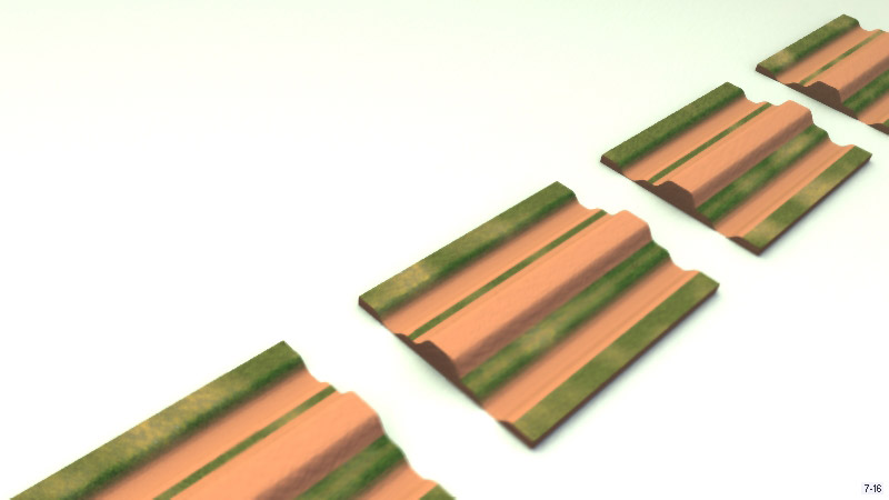
![]() Download an animation showing how the cursus might have been built in sections (requires QuickTime).
Download an animation showing how the cursus might have been built in sections (requires QuickTime).
![]()
Monument construction
Sometime between c. 3,600 and 3,300 BC, the small monuments and settlements gave way to a sequence of much larger and visually impressive earthwork monuments. The earliest of these may well have been a small “horseshoe shaped” earthwork enclosure (HE1), the entrance of which was aligned with sunset at the mid-winter solstice, as well as a potentially earlier group of timber posts. We can imagine the “horseshoe” monument holding a small group of people, perhaps the community leaders, who gathered together at mid-winter to hold ceremonies that involved solar observations. The material from the enclosure ditches suggests that the rest of the community may have taken part in feasting outside the enclosure. We can thus see how the community evolved the mechanisms for agreeing control and access to the landscape and its resources through increasingly elaborate ceremonies and architecture.

![]() Download an animation that shows people observing the winter solstice sunrise from the horseshoe enclosure, and the bank of the cursus (1.4MB, requires QuickTime).
Download an animation that shows people observing the winter solstice sunrise from the horseshoe enclosure, and the bank of the cursus (1.4MB, requires QuickTime).
The ultimate expression of this architecture was in a series of huge linear cursus monuments, the largest, though not necessarily earliest, of which was the Stanwell Cursus. This remarkable monument ran in an almost straight line for 3 kilometres from the River Colne in the northwest to the edge of the Taplow gravel terrace beneath Stanwell in the southeast. It consisted of two parallel ditches, the earth from which was used to build a single central bank.
The monument appears to have been set out very precisely so that it linked together and buried a line of earlier important locations such as the burnt flint pits, posthole groups and settlements. It was built as a series of sections, each c. 150 to 200 metres long, and each section could have been built by four people working for 16 to 20 weeks, perhaps by particular family groups associated with the earlier location or monument that lay beneath the cursus. The construction of the cursus fulfilled many roles, but perhaps its most important legacy was that it affirmed through the construction of a communal project and through communal labour the pre-eminence of a community consisting of component families.
The architectural impact of such a monument would have been immense, but the social implications would have been even more far-reaching. The Stanwell cursus now served as a stage for the leaders of the community to process along and undertake ceremonies at the places along its course, which still remained sacred to the family groups. Underlying these ceremonies was a need to negotiate and agree access to land and resources in an increasingly cleared landscape. Thus the community had made itself and set itself upon a new course of social interaction that also included the construction of three other cursus monuments (referred to as the C2, C3 and C4 cursus), smaller in length though occasionally much greater in width.
3,600-3,300 BC Cursus Landscape animation
![]() Download an animation showing the cursus (requires QuickTime).
Download an animation showing the cursus (requires QuickTime).
3,300-2,600 BC From Linear to Circular: Changing the Use of Space
![]() Download an animation that shows people observing the winter solstice sunrise from the horseshoe enclosure, and the bank of the cursus (1.4MB, requires QuickTime).
Download an animation that shows people observing the winter solstice sunrise from the horseshoe enclosure, and the bank of the cursus (1.4MB, requires QuickTime).
From Linear to Circular: Changing the use of space
In the later Neolithic, the type and nature of monuments changed, through a transformation from linear to circular space. This change may be linked to shifting conceptions concerning land, space, and social and community relations. For example, a small circular earthwork enclosure was constructed within the C2 cursus. The entrance of this “horseshoe shaped” enclosure was aligned with sunset at the mid-winter solstice. We can imagine the “horseshoe” monument holding a small group of people, perhaps the community leaders, who gathered together at mid-winter to hold ceremonies that involved solar observations. The material from the enclosure ditches suggests that the rest of the community may have taken part in feasting outside the enclosure. We can thus see how the community evolved the mechanisms for agreeing control and access to the landscape and its resources through increasingly elaborate ceremonies and architecture. Other small circular henge-like monuments with external banks were constructed at other key locations within the landscape. The circular monuments imply that meeting places had now become more formalised, structured and perhaps more proscriptive, underlying fundamental changes within the society as a whole.
Posted in The Monumental Landscape
Tagged animation, cursus, monuments, neolithic, solstice
Leave a comment